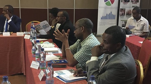
ADDIS ABABA (ENA)–A five-day capacity building on surveying infrastructure and geospatial information system was launched today at the Intercontinental-Addis Hotel.
Urban Land and Landed Property Registry and Information Agency Director-General, Solomon Kebede told journalists that the capacity building will speed up national growth.
Noting that land management and registry are at their infancy, Solomon said “we are looking forward to having qualified expertise that can interpret and disseminate geospatial information that is crucial to the overall development of the nation”.
According to the Director-General, geospatial mapping has already started in 12 cities and the number of towns that receive the service will reach 91 by the end of the Second Growth and Transformation Plane (GTP II).
“This capacity building with a full hope of its continuation will enable our professionals in aerial mapping, identifying geodetic control points and fill the national human capital gap,” the Director General added.
Korea Land and Geospatial Informatix Corporation (LX) Chief Business Director, Cho Man Seung said on his part land is one of the driving forces in the development of a country like Ethiopia and should be utilized through up to date technology.
Recalling that both Ethiopia and South Korea had signed memorandums of understanding to cooperate in land management and registry, Seung said this workshop is a showcase of its implementation.
LX Corporation has an abundant experience in cadastral survey and land information system, he said, and pointed out that “we can provide the kind of experience and know how especially in Unmanned Aerial Vehicle (UAV) and integrate it with land information system”.
Smart cities will be built in Ethiopia through urban information systems such as road, water and sewerage, river and public land management as well as parking lot management system and CCTV blind spot analysis, it was learned.
Utilization and monitoring of UAV, urban information system and solutions for the establishment of smart cities are among the areas to be addressed during the five days long capacity building program.
Korea Land and Geospatial Informatix Corporation, established as Korea Cadastral Survey Corporation in 1970, is currently engaged in 25 countries across the globe.
Participants from the Ministry of Urban Development and Housing (MWUD) Information Network Security Agency (INSA), federal and regional bureaus of urban land registry are taking part in the capacity building training.
Source: ENA
——
Other stories:
- INSA Signs Eutelsat Capacity for TV Platform in Ethiopia
- Ethiopia among Countries with Poor Urban Planning: Research
- Ethiopia Preparing to Build Planetariums: Ethiopian Space Science Society
- Ethiopia’s INSA Launches ‘Ethiosat’ Satellite Television Transmission Platform
- Ethiopia Telecoms, Mobile and Broadband Statistics and Analyses 2017 – Research and Markets
