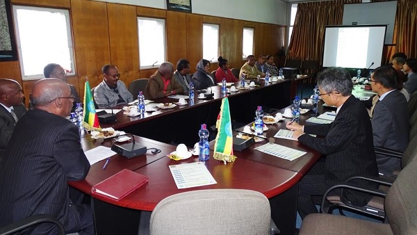
ADDIS ABABA (JICA)–After nearly five years, Japan International Cooperation Agency’s (JICA) digital topographic mapping project is drawing to a close. At the July 23rd, 2018 Joint Coordination Committee (JCC) meeting, members discussed the final phases of the project and concluding capacity building measures that can be taken.
Since October 2013 JICA has been working with the Ethiopian Mapping Agency, now the Ethiopian Geospatial Information Agency (EGIA), to develop topographic maps for the cities of Adama and Modjo, which cover 1,140km2 land in Oromia Region.
Accurate and reliable geospatial data is imperative for a nation, especially one that is in the midst of accelerated growth. The second phase of Ethiopia’s Growth and Transformation Plan (GTP II) outlines aggressive infrastructure development goals that are to be achieved by 2020. These goals cannot be realized without accurate, reliable and timely geospatial maps.
Ethiopia covers 1,000,000km2 of land and while the project scope focused on only 0.104% of the total country, the objective was to build the technical capacity of the EGIA.
“JICA support has come at the right time for our agency as we were transitioning from analog to digital maps. JICA support will enable us to produce medium and large scale maps since our prior experience was with mainly small-scale maps,” noted Mr. Sultan Mohammed, Director General, EGIA, during the JCC meeting.
JICA experts have trained a total of 121 employees, including trainers of trainers who will be able to transfer skills to stakeholders. During training sessions, trainees were able to use the data they gathered to create a tourist map of Adama city; of which, 6,000 copies have been printed and distributed in Adama.
Additionally, 1:25,000 and 1:10,000 topographic maps of Addis Ababa city, produced with JICA assistance, are being made available free of charge through the geoportal on EGIA’s website.
“We believe strongly that with the internet becoming a standard tool for public and private service providers, it is imperative for the geoportal of the EGIA to be accessible from all over the world,” encouraged Mr. Ken Yamada, Chief Representative of JICA.
EGIA has budgeted to improve its IT infrastructure in the upcoming Ethiopian fiscal year and intends to avail the geoportal 24 hours a day, seven days a week, in the coming year, according to Ato Sultan.
JICA will finalize its digital topographic mapping project in January 2019.
Source: JICA
